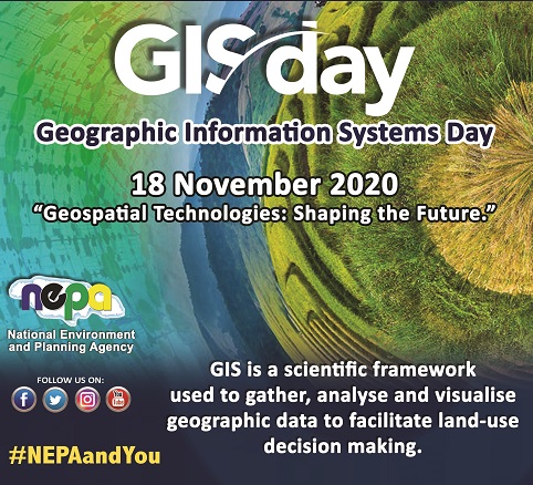
NEPA maps the future with GIS Day 2020
Published Date: November 16, 2020
Attention: All News Editors KINGSTON, Jamaica
(November 16, 2020):
NEPA MAPS THE FUTURE WITH GIS DAY 2020
The National Environment and Planning Agency (NEPA) will be commemorating Geographic Information System (GIS) Day, under the theme, “Geospatial Technologies: Shaping the Future.” From November 16-18, 2020, the Agency will execute activities that are aimed at helping members of the public and targeted stakeholder groups better appreciate how geospatial technologies are used in making critical planning and environmental decisions.
The Benefits of GIS
Speaking on the importance of this year’s celebrations, Mr. Eromonsele Akhindenor, GIS Coordinator, NEPA expressed, “GIS Day is a worldwide movement where users connect together to use the science of geography to better manage and plan for more resilient communities and a safer environment. The technology and tools available through GIS enables NEPA to make better environmental and planning decisions.”
NEPA is able to prepare land use information, map out the habitats of different species, develop and manage fish sanctuaries and designate eco-sensitive areas for protection. By processing geospatial data from satellite imagery, aerial photography and remote sensors, users gain a detailed perspective on land and infrastructure. In addition, the Agency collects air quality and water quality information to better understand pollution challenges.
GIS Day 2020 Activities
An interactive Story Map will be used to guide the user through the history of GIS technologies as used by NEPA. This will be available on the Agency’s social media pages, namely Instagram, Twitter and Facebook.
To better appreciate how these tools affect the lives of everyday Jamaican citizens, the Agency will premiere a video on its social media pages showcasing how GIS is used to guide Jamaica’s planned urban and rural development. The celebrations will feature a webinar with key technical presenters, on November 17, 2020. It will also highlight the role of GIS in the implementation of the Yallahs and Hope River Watershed Management Areas Project, coordinated by NEPA. Persons interested in attending the webinar should email NEPA at pubed@nepa.gov.jm to confirm their registration.
Note to the Editor
A geographic information system (GIS) is a framework for gathering, managing, and analyzing data. Rooted in the science of geography, GIS integrates many types of data. It analyzes spatial location and organizes layers of information into visualizations using maps and 3D scenes. GIS Day will be celebrated internationally on November 18, 2020.

-30-
For more information, please contact:
Public Education and Corporate Communication Branch
Tel: (876) 754-7540, ext. 2760 Fax: (876) 754-7596
Email: travis.bartley@nepa.gov.jm
Website: www.nepa.gov.jm
- Log in to post comments